

resilient Shorelines
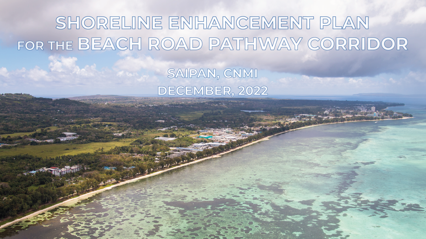
Shoreline Resiliency & Enhancement Plan for the Beach Road Pathway (Saipan, cnmi)
The Beach Road Pathway and adjacent shoreline connecting the business districts of Garapan and Susupe on Saipan has long been an area of concern for natural resource stewards, recreational stakeholders, and the network of CNMI agencies involved in managing infrastructure. The corridor checks all the boxes for a high priority resilience project: consistently narrow shoreline buffer, close proximity of high value community assets and adjacent infrastructure, and documented exposure to periodic extreme weather events, wave run-up, and sea level changes.
This combination of factors also translated into the CNMI’s highest concentration of “resilience hubs” and priority restoration sites, as delineated by the 2020 NFWF Coastal Resilience Assessment for the CNMI.
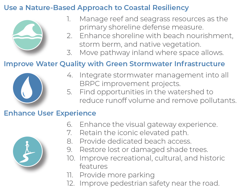
There couldn’t be a better canvas to design and implement nature-based solutions for coastal resiliency in the Northern Mariana Islands, so that’s exactly what we’re doing!
Pacific Coastal Research and Planning | Horsley Witten Group, Inc. | CNMI Department of Public Works | Shoreline Conservation Initiative
Implementation
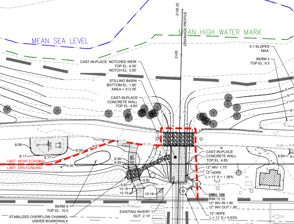
Check out the final permitting plans for our shoreline and stormwater enhancements at Chalan Laulau, Beach Road. Water quality treatments, vegetated storm berms, and shoreline access paths will be developed through a collaborative effort with CNMI Department of Public Works, the National Coastal Resilience Fund, and U.S. EPA.
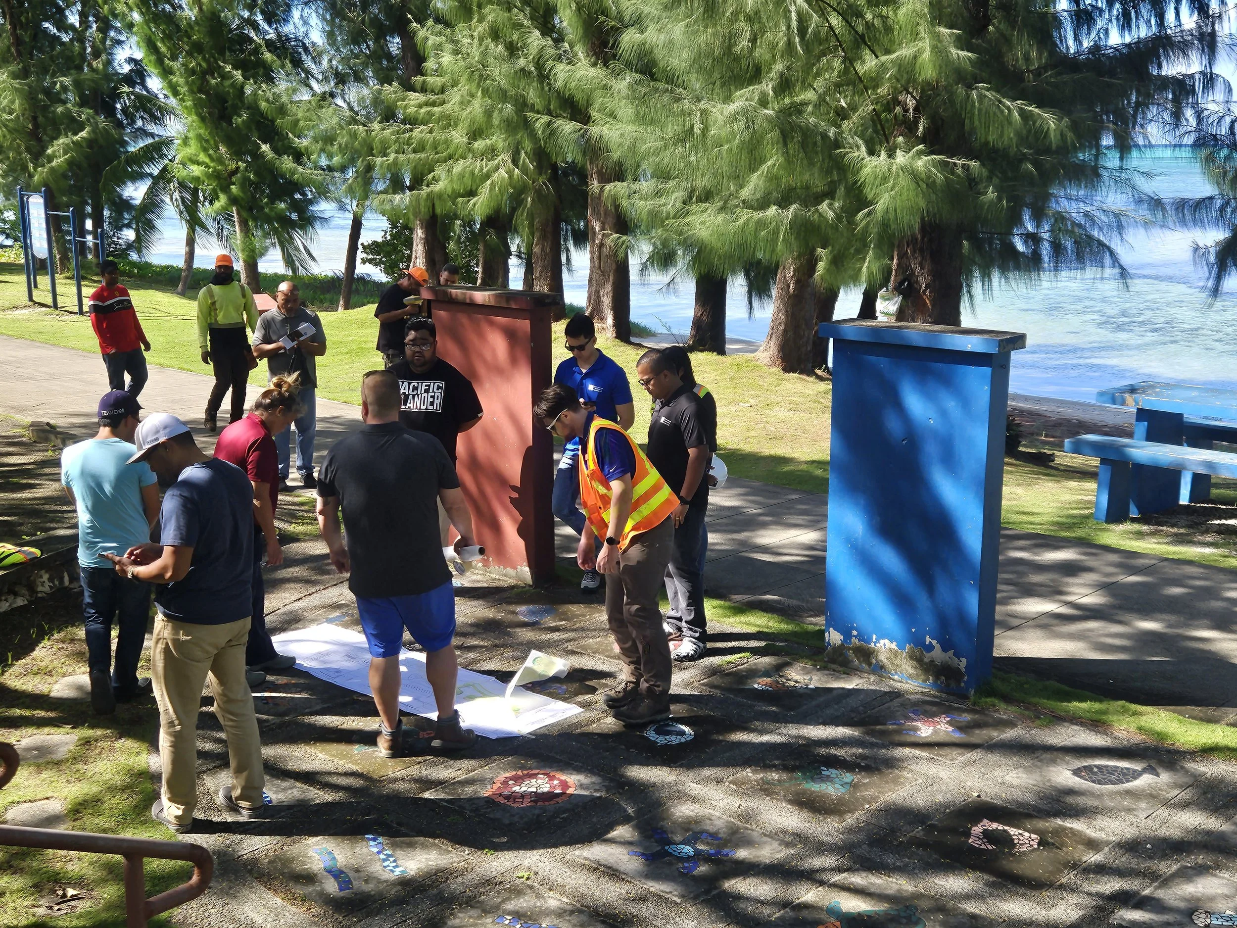
The Beach Road Pathway Corridor Advisory Committee and personnel from CNMI BECQ gather on-site to review draft designs and permit plans.
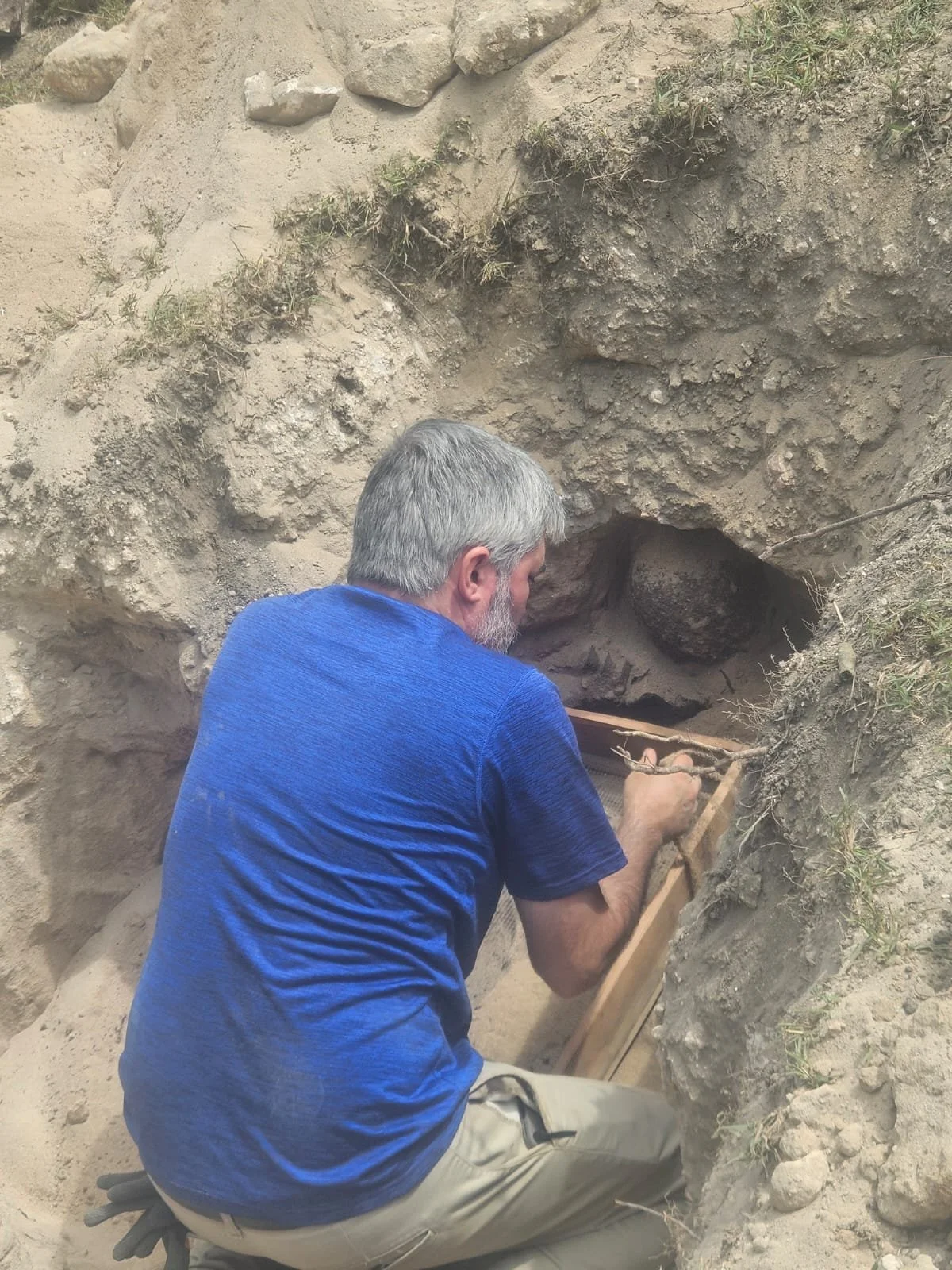
Archaeological surveys reveal a young Japanese soldier - the Chalan Laulau shoreline enhancement site is situated directly within the WWII Landing Beaches historic district.
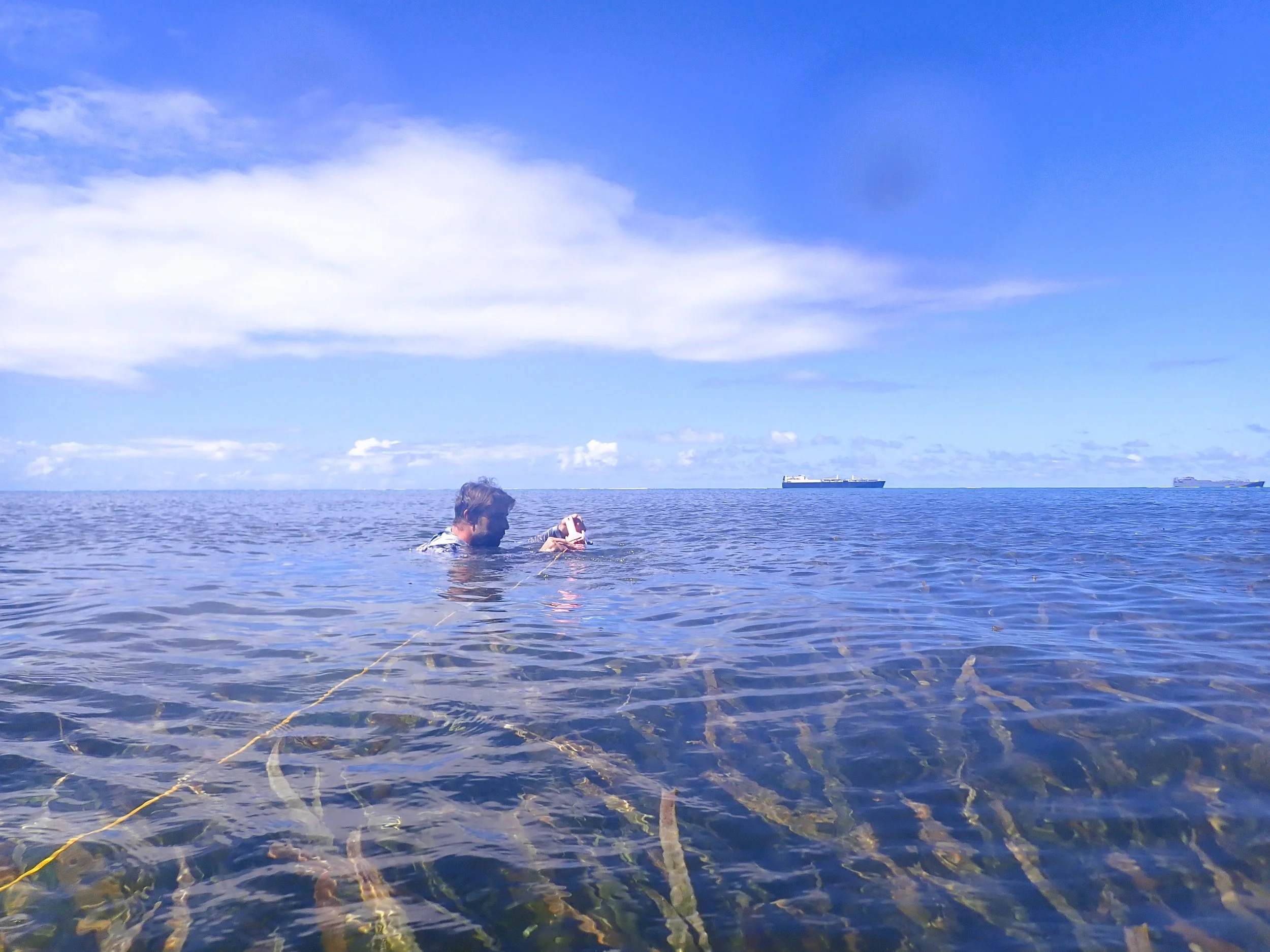
PCRP conducts in-water belt transect surveys of the Enhalus seagrass beds that dot the adjacent Saipan Lagoon.
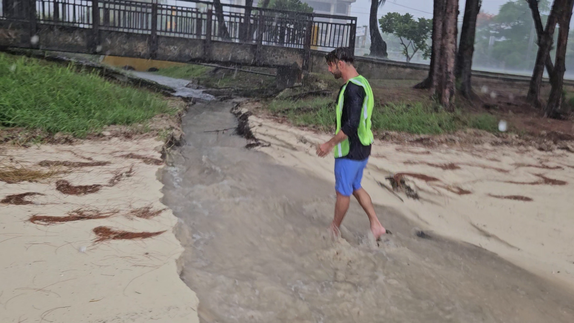
PCRP documenting an extreme rainfall event in 2025, which overwhelmed the existing stormwater infrastructure in less than 2 hours.
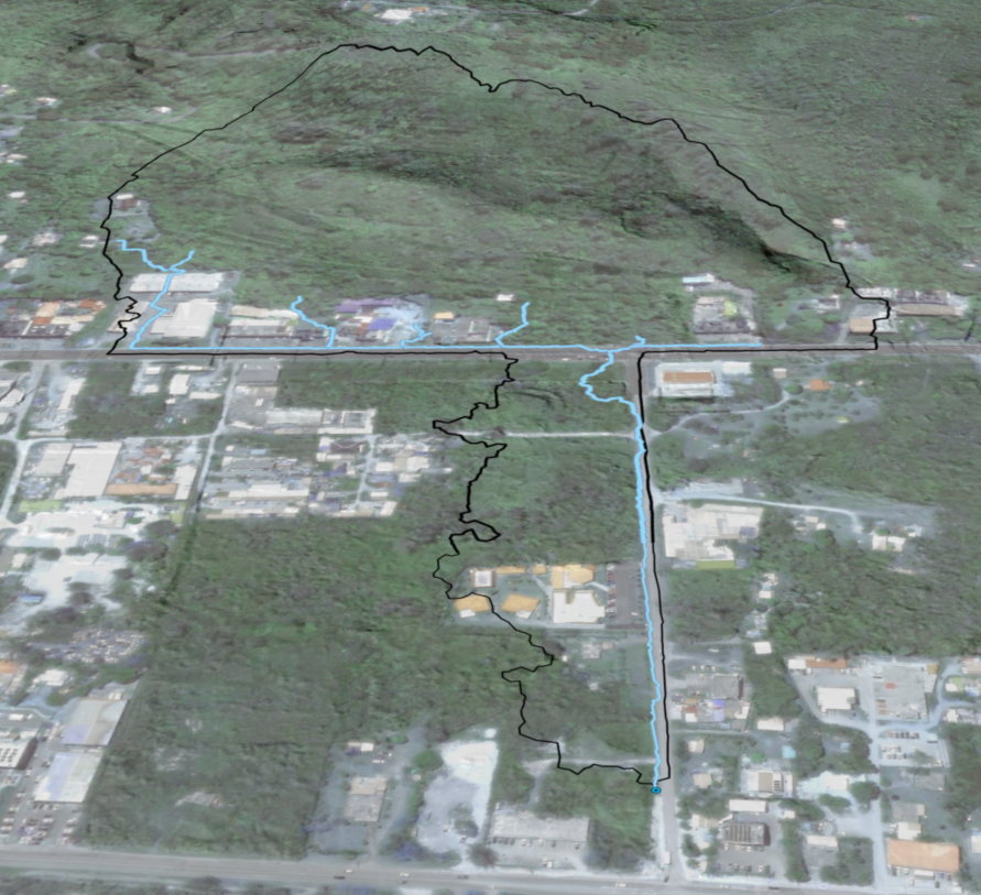
High resolution airborne lidar data allowed the team to conduct rigorous analysis of stormwater volumes, potential pollutant loading, and delineate upland hydrology for receiving sites along the Saipan Lagoon shoreline.
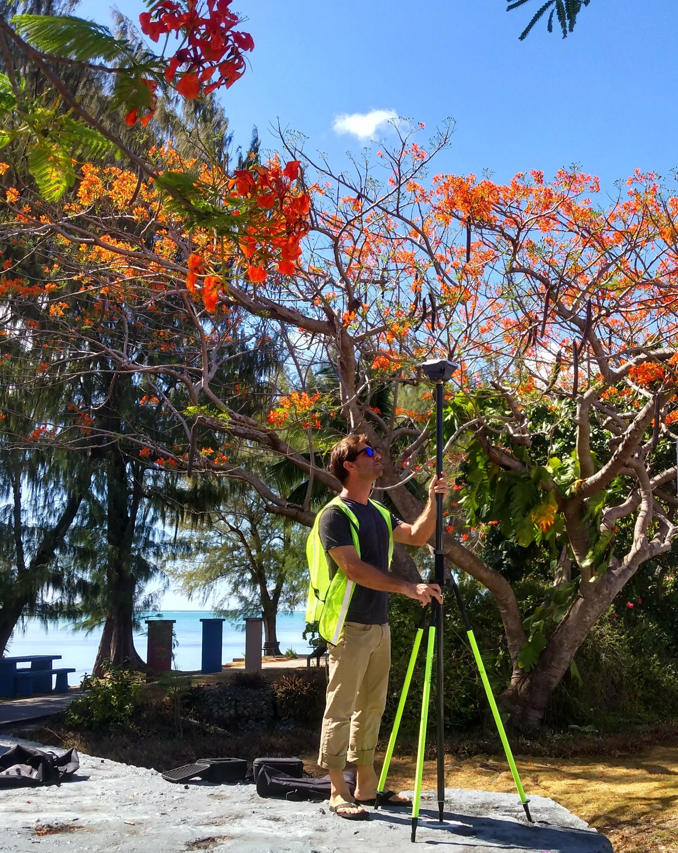
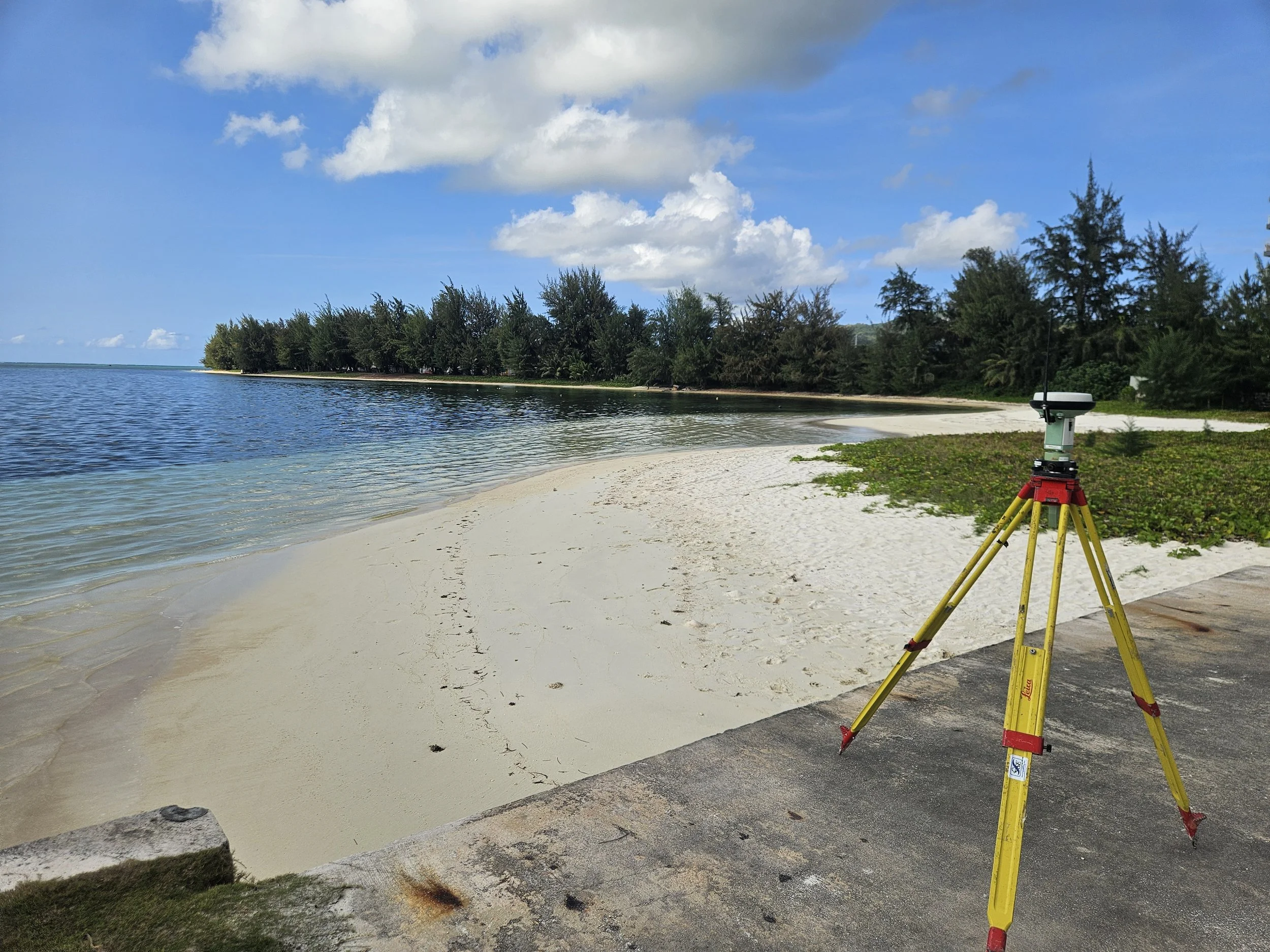
PCRP conducting an RTK survey on site to pinpoint shoreline berm positions, elevations, and angles.
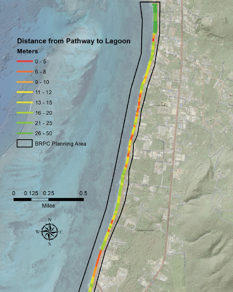
During the Beach Road Shoreline Enhancement visioning process, extensive surveys were conducted along a 3-mile stretch of coast. This map highlights exposure of the beach road pathway to coastal hazards.

Stormwater engineers from Horsley Witten Group and Hofschneider Engineering Corporation discuss possible design interventions with the existing stormwater outfall at Chalan Laulau.
To determine feasibility of beach nourishment options, PCRP worked with Sea Engineering Inc. to identify, analyze, and quantify compatible sand sources (Pictured: A large volume of accreted sand blocks the Sugar Dock boat launch in 2024)